Matrice 4E
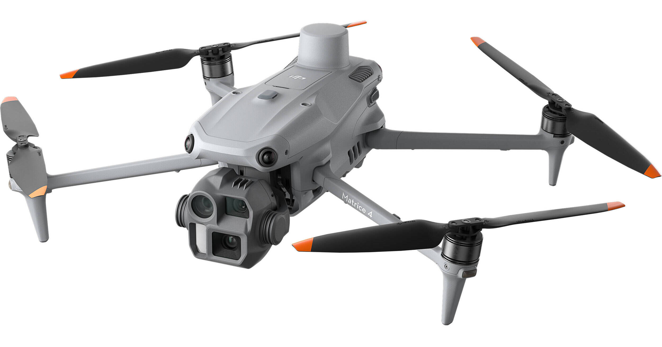
DJI Matrice 4E
A Precision Tool for Surveying and Mapping
The DJI Matrice 4E (M4E) has been meticulously engineered to address the demands of geospatial professionals. Its intelligent design and advanced features streamline surveying and mapping tasks, ensuring greater accuracy, efficiency, and ease of use.
Quick Specifications
| Feature | Capability |
| Max Flight Time | 49 minutes (with RTK module) |
| Mapping Boost | Up to 40% productivity increase |
| Image Interval | 0.5 seconds |
| Accuracy | Centimeter-level (RTK) |
| Distortion | < 2 pixels |
High Efficiency
The M4E redefines productivity in the field, allowing operators to cover more ground in less time without sacrificing data quality.
-
Extended Flight Time: With a maximum flight time of 49 minutes when equipped with an RTK module, the M4E outperforms previous models. This enables longer continuous operations and significantly reduces the need for frequent battery changes on large sites.
-
Multi-Directional Imaging: Features 3-directional ortho capture and 5-directional oblique capture. This versatile payload enhances mapping productivity by up to 40% compared to traditional aerial surveying methods.
-
Rapid Imaging: The camera captures images at intervals as short as 0.5 seconds, allowing for high-speed flight paths and rapid mapping over expansive areas.
Precision Technology
Accurate data is the foundation of any surveying operation. The M4E leverages next-generation calibration and positioning hardware to deliver reliable, survey-grade results.
-
Distortion Correction 2.0: An upgraded internal correction system ensures residual lens distortion of less than 2 pixels, resulting in exceptional imaging accuracy right out of the camera. When paired with factory-calibrated sensors and DJI Terra software, the system delivers highly precise 3D reconstructions.
-
RTK Accuracy: Built-in Real-Time Kinematic (RTK) capabilities provide continuous, centimeter-level positioning for absolute precision in georeferencing your maps and models.
Simplified Operations
Advanced capabilities shouldn't mean a steeper learning curve. The M4E ecosystem is designed to be intuitive from flight planning to final rendering.
-
Smart 3D Capture: Fully integrated with DJI Terra directly on the remote controller. This allows users to easily generate optimized mapping routes and create detailed 3D models in the field without needing to transfer data to external devices.
-
Obstacle Avoidance: A robust array of advanced sensors enables the drone to navigate complex, cluttered environments safely. This makes close-range structural inspections, urban mapping, and low-altitude modeling significantly more manageable and risk-free.
Pairs well with
Matrice 4E
If you have any questions, you are always welcome to contact us. We'll get back to you as soon as possible, within 24 hours on weekdays.
Shipping Information
Use this text to answer questions in as much detail as possible for your customers.
Customer Support
Use this text to answer questions in as much detail as possible for your customers.
FAQ’s
Use this text to answer questions in as much detail as possible for your customers.
Contact Us
Use this text to answer questions in as much detail as possible for your customers.